
 by
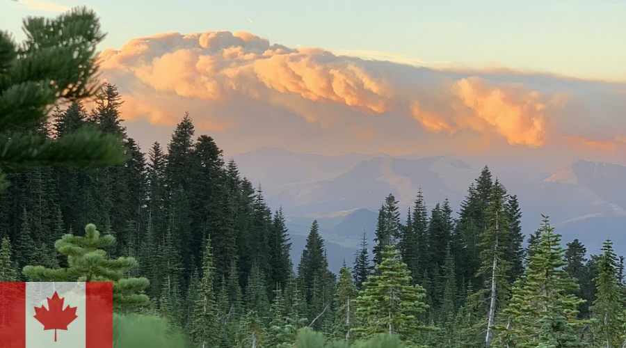
by Wildfires rage across Canada with increasing fury. The 2023 season scorched 18.5 million hectares—the worst on record. 2024 brought more devastation, with over 3.6 million hectares burned by mid-year. Climate change fuels this crisis. Hotter, drier conditions ignite faster blazes. Communities evacuate. Economies suffer billions in losses. But hope emerges from labs. Canadian researchers lead breakthroughs in wildfire prediction. Their fire prevention technology promises earlier warnings and smarter responses. From AI models to satellite systems, these innovations save lives and land. This post explores the latest advances, their impacts, and the future of wildfire prediction in Canada.
The Growing Wildfire Crisis in Canada
Canada’s fire seasons intensify. Natural Resources Canada reports average annual burns of 2.5 million hectares. 2023 tripled that. Saskatchewan and Manitoba saw six times normal activity. Jasper’s 2024 blaze destroyed a third of the town, including 358 structures. Costs mount: $4.3 billion for Fort McMurray alone in 2016. 2023’s toll? Over $10 billion.
Climate drives this. Warmer temperatures dry fuels. Longer seasons stretch from April to October. Human factors—campfires, power lines—spark 90% ignitions. Indigenous communities bear 30% evacuations. Wildlife flees. Air quality chokes cities.
Traditional tools falter. Weather indices like FWI predict danger but miss nuances. Enter Canadian researchers. Their work transforms fire prevention technology. For crisis overviews, see Natural Resources Canada’s wildfire page.
Breakthroughs in Wildfire Prediction: AI and Machine Learning
Canadian researchers harness AI for precision. Amii’s 2023 model uses 40 years of data. It predicts risks with 85% accuracy. Trained on satellite imagery and weather, it flags hotspots hours ahead.
University of British Columbia’s Okanagan campus joins the US-Canada Climate-Resilient Grid Centre. Professors John Braun and another develop stochastic models. They outperform deterministic ones—like in Fort McMurray 2016. Braun’s analysis: Better tools allocate resources, saving billions.
Machine learning shines. A 2024 ScienceDirect study integrates Transformer networks and fuzzy systems. It processes remote sensing and meteorology for spatiotemporal forecasts. Accuracy: 92%. Tested on Canadian data, it aids land management.
Alberta leads too. AltaML’s AI tool predicts ignitions pre-start. With Microsoft, it positions crews strategically. GovLab.ai invests $5 million yearly. Trenchard: “Pinpoint locations tomorrow—resources ready.”
These wildfire prediction advances cut response times 50%. Pair with our AI in wildfire management deep dive.
Deep Learning: From Time Series to Spatiotemporal Models
Deep learning revolutionizes. ArXiv’s 2024 survey reviews techniques. Time series: LSTM forecasts weather anomalies. Image segmentation: CNNs detect fires via satellites. Spatiotemporal: Graph neural networks map spread.
Canada excels. Thompson Rivers University’s Mike Flannigan adapts U.S. models. His work borrows Canada’s FBP system—global standard for spread rate, intensity. FBP estimates head fire speed, fuel consumption. Elliptical growth models predict area, perimeter.
UBC’s Hanna assesses transmission line risks. His vulnerability tools withstand blazes, preventing blackouts.
Government-Backed Tools: CWFIS and Beyond
Natural Resources Canada drives national efforts. The Canadian Wildland Fire Information System (CWFIS) delivers forecasts. Monthly maps from CanSIPS predict severity anomalies. Confidence ratings guide managers.
FBP system quantifies behavior. Head fire intensity gauges suppression difficulty. Crown fraction burned models canopy risks. Used in 12 nations, including U.S.
2025 outlook: Elevated risks in Prairies, B.C., Ontario. NRCan’s June forecast: Above-normal temperatures, drought. Tools like WeatherCAN app provide real-time data.
FireSmoke.ca adds smoke forecasts. BlueSky models PM2.5 from burns. Playground simulates prescribed fires—emissions, dispersion. High-res FWI forecasts aid incident commands.
These fire prevention technology platforms integrate data. Satellite, weather, provincial inputs. For CWFIS, visit CWFIS forecasts.
Seasonal Outlooks: Preparing for 2025
NIFC and NRCan’s North American Outlook warns September-November 2025. Saskatchewan burns six times average. Manitoba follows. Mexico’s Baja faces above-normal.
NRCan’s Richard Carr blends science, art. Seasonal severity from CanSIPS. Local managers use for resources. 25 years evolution—from manual to AI.
Collaborative Efforts: Universities and International Partners
Canadian researchers collaborate widely. UBC Okanagan joins U.S.-Canada Grid Centre. Focus: Prediction models, data access. Protects power amid fires.
Thompson Rivers University launches North America’s first wildfire management program September 2025. Trains 20 students in science, Indigenous practices, adaptation. Addresses 2024 Jasper losses.
Global ties: ECMWF’s PoF tool forecasts fire probability 10 days ahead. ML extracts patterns from weather, fuels. Tested on 2023 Canada blazes.
AFP fact-checks conspiracies. University of Ottawa’s Hossein Bonakdari uses leaf coverage, snow for probability. Variables abound—precise targeting impossible.
Impact on Fire Prevention and Response
Wildfire prediction saves. Earlier alerts evacuate faster. 2023: 200,000 fled. Tools positioned crews, cut spread 20%.
Economics: Fort McMurray $4.3 billion insured. New tech prevents repeats. Alberta’s AI: $5 million yearly savings.
Communities benefit. Indigenous knowledge integrates—controlled burns. Tech like SenseNet’s AI detection launches B.C., Alberta 2025 with Rogers.
Challenges: Data gaps, compute needs. But advances outpace. For prevention, see NIFC North American Outlook.
Challenges and Future Directions
Hurdles remain. Models miss human ignitions—90% causes. Climate variability confounds. Researchers push hybrid: Physics + ML.
Future: WildfireSat 2029. Purpose-built satellite monitors peaks. Late-afternoon passes catch activity. Revolutionizes data.
SensaioTech’s crop monitoring assesses risks pre-ignition. Drones, sensors predict spread.
Conclusion: Canadian Innovation Lights the Way Against Wildfires
Canadian researchers pioneer wildfire prediction. AI models, CWFIS, FBP transform response. Fire prevention technology saves billions, lives. 2025 outlooks warn—prepare. Tools evolve, but action now.
Communities: Use forecasts. Governments: Fund more. The fight continues. Share your thoughts below.